


Food Directorate and CGCOST to use satellite imagery, remote sensing and GIS for accurate mapping of paddy cultivation
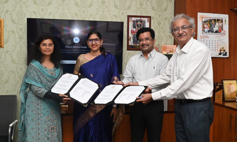
Raipur: Chhattisgarh has taken a technology-driven step towards obtaining more accurate and reliable data on the actual area under paddy cultivation. The Directorate of Food, Civil Supplies and Consumer Protection, Chhattisgarh, and the Chhattisgarh Council of Science and Technology (CGCOST) have signed a Memorandum of Understanding (MoU) to map and verify paddy cultivation using satellite imagery, remote sensing and Geographic Information System (GIS) technology.
The initiative is aimed at improving the accuracy of paddy acreage assessment and strengthening the coordination between land records, digital crop surveys and satellite-based crop verification. The technology-based system is expected to provide more reliable geospatial data for processes associated with paddy procurement.
The MoU was signed in the presence of Principal Secretary, Department of Science and Technology, Sonmani Bora; Secretary, Food, Civil Supplies and Consumer Protection Department, Reena Baba Saheb Kangale; Director, Food, Civil Supplies and Consumer Protection, Dr. Fariha Alam; and Director, CGCOST, Kaveshwar.
GIS Mapping of FRA and Submergence Areas
A key component of the initiative will be the identification and digital mapping of agricultural land located in Forest Rights Act (FRA) areas and submergence-affected areas where georeferenced digital records are currently unavailable.
GIS-based polygon layers will be prepared for such agricultural parcels to establish their digital geographical identity. Satellite imagery and remote-sensing technology will then be used to assess the area under paddy cultivation in these locations.
This approach is expected to improve the availability of reliable geospatial information in remote and difficult-to-map areas where conventional land records can pose challenges for digital crop verification.
Satellite Data to Verify Paddy Cultivation
In other georeferenced agricultural areas, the latitude and longitude of identified land parcels will be matched with satellite imagery. This will allow the presence of paddy cultivation on individual agricultural plots to be technically verified.
The integration of satellite imagery with GIS-based mapping is intended to reduce dependence on manual assessment and enable systematic analysis of crop conditions across large geographical areas.
Digital Crop Survey to Get Stronger Geospatial Support
The collaboration between the Food Directorate and CGCOST will also strengthen the geospatial foundation required for digital crop surveys.
The digital mapping of FRA and submergence areas will help bring agricultural parcels in these locations into a more structured digital framework. Land-related digital information, crop-survey data and satellite-based verification can then be used together to build a more comprehensive picture of actual crop acreage.
According to reports on the initiative, the polygon layers and geospatial data are intended to support the assessment of actual paddy acreage for the Kharif Marketing Year 2026–27.
Technology-Based Data for Paddy Procurement
Accurate information on the area under paddy cultivation is important for a state where paddy procurement is carried out on a large scale. The new system is designed to increase the use of satellite and geospatial data in acreage verification and provide more reliable information for procurement-related processes.
The initiative will bring land records, GIS mapping, digital crop surveys and satellite-based crop verification into closer coordination. This is expected to strengthen the data foundation for assessing paddy acreage and support greater transparency and reliability in the procurement system.
The MoU marks a significant move towards using modern geospatial technology for agricultural data management in Chhattisgarh, particularly for areas where conventional digital mapping has remained challenging.